


The Amazonian river-floodplain systems face unprecedented threats from the construction of hydroelectric power plants aimed at meeting Brazil's energy demands. However, evidence suggests that the long-term economic, social, and environmental damages outweigh the hydroelectricity advantages. The Volta Grande do Xingu was dammed and its water diverted to energy production, resulting in habitat loss due to the altered hydrological regimes. Flooded environments are vital for ecosystem services, including food production, biogeochemical cycles, and climate regulation. The construction and operation of hydropower plants disrupt these services, affecting Indigenous populations and ribeirinhos communities. Environmental Impact Assessments often underestimate these impacts, and the responsibility for monitoring falls on the companies themselves, leading to conflicts of interest and inadequate reporting. This triggered an Independent Territorial Environmental Monitoring (MATI-VGX) initiative, led by Indigenous and ribeirinhos researchers in partnership with academics. MATI-VGX's observations reveal changes in flooded ecosystems, including increased seedling density and leaf-cutter ant colonies in the understory, changes in plant species composition, disruption of the phenological cycle, and vegetation mortality. Moreover, reduced fruit dispersion disrupts the aquatic food web and threatens Indigenous and ribeirinhos food sources. These changes indicate ecosystem decay and disruption of ecological processes. Importantly, these impacts are noticeable after a short period of water diversion, highlighting the urgency of mitigation efforts. A research agenda must quantify tree mortality, understand physiological mechanisms, and assess the cascade effects on wildlife and food security. Ultimately, restoring natural hydrological patterns is essential for preserving Amazonian biodiversity and the livelihoods of Indigenous and ribeirinhos communities.

The integrity and functioning of Amazonian aquatic ecosystems and its biocultural diversity are under threat due to the unprecedented intensification of hydroelectric power plants constructions, allegedly driven by Brazil's growing demand for energy (Latrubesse et al., 2017; Athayde et al., 2021; Schöngart et al., 2021). Constructing hydropower plants sparks heated debates over political and national economic interests in energy production. The trade-off between ecosystem conservation and energy generation is complex (Fearnside, 2019). But in spite of such controversies, benefits of hydropower plants in Amazonia are unlikely to overcome the long-term economic-social-environmental damages (Fearnside, 2019; Schöngart et al., 2021). Although once considered green-choices, the current consensus is that significant emission of greenhouse gas (Bertassoli et al., 2021), high socio-environmental impact, and prospects of inefficiency due to intensification of droughts driven by global warming make hydropower plants in Amazonia worrisome (Fearnside, 2019; Anderson et al., 2018; Moran et al., 2018).
Due to the connection to rivers, the flooded forests are among the ecosystems most negatively affected by hydroelectric dams. Changes in the hydrological regimes drastically impact seasonally flooded ecosystems, which represent nearly 12% of the Amazon basin and cover an area of 760,000 km2, from which 70–90% are flooded forests (Wittmann and Junk, 2016). Flooded forest trees and herbaceous species have developed a range of morpho-anatomical, physiological, and biochemical adaptations to seasonal inundation over different evolutionary timescales (Piedade et al., 2010; Wittmann et al., 2010), and therefore are highly sensitive to variations in the inundation levels (i.e., Householder et al., 2021). Floodplain forests harbor elevated numbers of specialist and endemic species (Wittmann et al., 2022). The alternation between terrestrial and aquatic phases provides numerous habitats for plants and animals, as well as fish nursery areas that are crucial for population stability and feeding grounds for the terrestrial fauna (Wittmann and Junk, 2016). Moreover, several fish species such as pacus, piaus, and catfish disperse fruits and seeds through ichthyochory (i.e., Gottsberger, 1978; Kubitzki and Ziburski, 1994), promoting genetic flow and diversity of plants (Correa et al., 2007; Weiss et al., 2016). This interplay between the aquatic fauna and the vegetation is highly dependent on a seasonal and natural hydrological regime, which is coupled with the South American monsoon (Marengo et al., 2010) in seasonally to evolutionary timescales.
Therefore, hydroelectric dams have multifaceted impacts on aquatic and terrestrial ecosystems and cause significant habitat loss both upstream and downstream (Forsberg et al., 2017; Schöngart et al., 2021), resulting in the ecosystem services decay (Box 1). Upstream, reservoirs submerge vast areas, degrading terrestrial and aquatic habitats and the slow decomposition of organic material under anaerobic conditions results in the formation of greenhouse gases, especially CH4 (Kemenes et al., 2016; Moser et al., 2019). Downstream, the effects are less understood, but significant changes in floodplain tree species composition (i.e., Lobo et al., 2019; Rocha et al., 2019) and mass mortality of specialist tree species have been reported up to 120 km downstream of the dam (Resende et al., 2019).
These impacts must be assessed during the licensing process for hydropower plant implementation, as mandated by Brazilian law. This process requires a thorough study of the anticipated social and environmental effects, including consultations with Indigenous and other traditional communities, as required by the Brazil constitution and Convention 169 of the International Labor Organization, along with the development of a mitigation and monitoring plan to be executed after the dam implementation. However, it is well-known that these environmental impact assessments systematically underestimate the effects of disruption of hydrological regimes and its consequences on terrestrial and aquatic food chains (Schöngart et al., 2021; Wittmann et al., 2022) and displacements of traditional communities (Mayer et al., 2021). Therefore, there is a general lack of trust in the licensing process of hydroelectric power plants in Brazil.
This was the case of the Belo Monte hydropower plant in the Xingu River, Brazil, operated by Norte Energia Inc., and one of the most controversial power plants of the century. The legality of the licensing process of Belo Monte was contested in more than 20 lawsuits filed by the Public Prosecutor’s Office (Pezzuti et al., 2024). The region in which the Belo Monte plant was implemented is known as Volta Grande do Xingu (VGX, Xingu Great Bend in English), and it brought the energy sector’s attention due to the high-water discharge and relatively steep slope of the Xingu River as a consequence of its positioning near the northern boundary of the Brazilian plateau (EPE/MME, 2007; Wittmann and Junk, 2016). The Belo Monte hydropower complex reservoirs were filled in December 2015 (Ritter et al., 2017), and since then, Norte Energia Inc. has been conducting periodic monitoring of socio-environmental conditions in the impacted areas. This monitoring is a mandatory requirement from the Brazilian authorities for licensing hydropower plants. However, Brazilian law presents a paradox in its monitoring scheme: the companies responsible for causing environmental impacts are also tasked with monitoring them. Therefore, failure to mitigate the impacts or to provide satisfactory information can ultimately lead to the suspension of the hydropower plant license by the relevant regulatory agencies. This leaves the wolf to guard the sheep and, thus, transparency and neutrality in impact assessment are highly compromised. This conflict of interest in the monitoring scheme can ultimately lead to socio-ecological tragedies (Dias et al., 2017; Moreira et al., 2022).
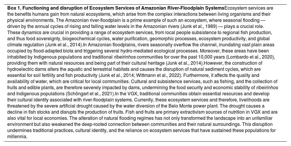
| Box 1. Functioning and disruption of Ecosystem Services of Amazonian River-Floodplain SystemsEcosystem services are the benefits humans gain from natural ecosystems, which arise from the complex interactions between living organisms and their physical environments. The Amazonian river-floodplain is a prime example of such an ecosystem, where seasonal flooding — driven by the annual cycles of rising and falling water levels in the Amazonian rivers (Junk et al., 1989) — plays a crucial role. These dynamics are crucial in providing a range of ecosystem services, from local people subsistence to regional fish production, and thus food sovereignty, biogeochemical cycles, water purification, geomorphic processes, ecosystem productivity, and global climate regulation (Junk et al., 2014).In Amazonian floodplains, rivers seasonally overflow the channel, inundating vast plain areas occupied by flood-adapted biota and triggering several hydro-mediated ecological processes. Moreover, these areas have been inhabited by Indigenous populations and traditional ribeirinhos communities for over the past 10,000 years (Lombardo et al., 2020), providing them with natural resources and being part of their cultural heritage (Junk et al., 2014).However, the construction of hydroelectric dams alters the aquatic and terrestrial habitats and causes the disruption of natural sediment cycles, which are essential for soil fertility and fish productivity (Junk et al., 2014; Wittmann et al., 2022). Furthermore, it affects the quality and availability of water, which are critical for local communities. Cultural and subsistence services, such as fishing, and the collection of fruits and edible plants, are therefore severely impacted by dams, undermining the food security and economic stability of ribeirinhos and Indigenous populations (Schöngart et al., 2021).In the VGX, traditional communities obtain essential resources and develop their cultural identity associated with river-floodplain systems. Currently, these ecosystem services and therefore, livelihoods are threatened by the severe artificial drought caused by the water diversion of the Belo Monte power plant. The drought causes a decline in fish stocks and disrupts the production of fruits. Fish and fruits are primary extractivism sources of nutrition in VGX and are also vital for local economies. The alteration of natural flooding regimes has not only transformed the landscape into an unfamiliar environment but also weakened the deep-rooted connection between communities and their natural surroundings. This disruption undermines traditional practices, cultural identity, and the reliance on ecosystem services that have sustained these populations for millennia. |
The lack of trust in the reports, and monitoring performed by Norte Energia triggered the social organization of Juruna Yudjá people of the Paquiçamba Indigenous Territory, through the Associação Yudja Mïratu da Volta Grande do Xingu (AYMIX), independently collect and process quantitative and qualitative data since 2014 (Pezzuti et al., 2018). Later, in 2020, the initiative expanded to include other Indigenous and ribeirinhos communities to form the Independent Territorial Environmental Monitoring (MATI-VGX) initiative, which includes aquatic fauna, fisheries, water quality, and water levels, with new subjects included in the monitoring as needed, such as the effects of water subtraction of the floodplain forests in the VGX. By using the data collected by the MATI-VGX initiative, our goal is to evaluate the state of the seasonally flooded ecosystems in the dewatered area of VGX downstream of the Pimental Dam. The subtracted water was diverted for energy generation in the main Belo Monte powerhouse and caused a 70%–80% reduction of Xingu River flow in the VGX stretch (Pezzuti et al., 2018). We used an approach that centers on local knowledge, combining it with an academic methodological and analytical framework to evaluate the disruption of ecosystem processes caused by the changes in the hydrologic regime in the VGX. The records reported here were mostly done by Indigenous and ribeirinhos that inhabit the area and reiterate the role of independent monitoring initiatives to better portray the magnitude of impacts of hydrological disturbances in seasonally flooded ecosystems. In light of our findings, we discuss and suggest potential mitigation actions aimed at restoring ecological processes in this distinct Amazonian ecosystem.
Ecological context and monitoring frameworkStudy areaThe Middle-Xingu region is characterized by alternating sections of abrupt bedrock topographic slopes with altitudinal differences of approximately 100 meters and possesses one of the largest hydropower potentials in eastern Amazonia (EPE/MME, 2007). The climate and its seasonal to millennial variability are related to the dynamics of the South American Monsoon, which promotes a well-defined rainy season during the austral summer (Marengo et al., 2010; Bertassoli et al., 2019). The mean air temperature is 26 °C, with an average annual rainfall of 2,289 mm.
The Xingu River is a clear-water river and its associated seasonally flooded forested ecosystems are known as igapó (Junk et al., 2015). The waters are relatively poor in suspended sediment and originate from deeply weathered Paleozoic-Mesozoic sedimentary and Precambrian metamorphic rocks of the Central Brazilian Plateau (Junk et al., 2011). Regarding ecosystem fertility, clear-water igapós may be highly variable, but usually intermediate between white-water (nutrient-rich) and black-water (nutrient-poor) floodplains (Junk et al., 2011). Floodplain forests are composed of tree specialist species from both, black-water and white-water floodplains (Junk et al., 2015).
The Belo Monte Hydropower Plant has an installed capacity of 11,233 MW and comprises a first dam (Pimental) impounding the Xingu River to transfer waters through an artificial channel for a second dam (Belo Monte), which contains the main powerhouse. Building licenses were granted in 2010 and 2012 after more than three decades of dispute and despite non-compliance with requirements from the federal agency of the Ministry of Environment, the Brazilian Institute of Environment and Renewable Natural Resources (IBAMA) (Fearnside, 2012). The construction of the Belo Monte hydropower plant began in July 2011, with the first generating units starting operation in April 2016, and full operation commencing in November 2019 (Pezzuti et al., 2018). The diversion of the Xingu River results in reduced water discharge in a 130-km-long stretch of the river channel known as the Volta Grande do Xingu. Seasonal water-level changes of the Xingu River average 3−4 m, with the highest flood levels in March/April, and the lowest flood levels in July/August (Fassoni-Andrade et al., 2021). After the construction of the Belo Monte Hydropower Plant, the flood amplitude in VGX was reduced to 1.2–1.6 m, and there has been a delay of 1–4 m in the flooding of some igapó forests compared to their natural periods (Juruna et al., 2025, in press). This study was conducted eight years after the start of the operation of the Belo Monte Hydropower Plant in VGX and the surrounding area, and two years after the beginning of its full operation, which caused a subtraction of >70% of the river discharge to VGX and drastically impacted the socioenvironmental system of the area.
Vegetation monitoringThe MATI-VGX-vegetation component began in 2021 and aims to monitor flooded forests in areas selected by Indigenous and ribeirinhos based on their local knowledge. The criteria for selection were the areas that serve as the most important habitats for fish nurseries. These areas are locally named after the word with Tupi origin Piracemas. Piracema can have different meanings in Brazilian Portuguese, and in the context of the VGX region, it is defined as seasonally flooded habitats along river channels, streams, waterways, and lakes where fish and other aquatic animals move throughout their life cycle and use to reproduce, seek shelter and feed. The monitoring of Piracemas consists of visits from local researchers to record information on the state of the vegetation based on a collectively developed structured form. The form contains questions on whether or not some event has been observed, e.g., if fallen fruits are observed on the forest floor (YES or NO) when the forest should be flooded (Tablel S1). Observations and habitat state are documented through date-tagged georeferenced pictures shared with all MATI-VGX participants. In the case of sarobais (a specific type of vegetation that is proportionally smaller and develops over rock and sand riverbeds at higher flood levels), the observations are done using photographic documentation of phenological characteristics and vegetation health during regular walks along the whole year. Special attention is paid to dead or excessively dry trees (e.g., with brown leaves) and fruit production, which are essential for aquatic fauna. This cooperative approach between local experts and academic researchers ensures that the data collection process is both culturally sensitive and scientifically rigorous.
In addition, eight 50 × 100 m (0.5 ha) permanent forest plots in impacted and non-impacted areas were established in igapó forests as part of the MATI-VGX protocol in 2023 (diamonds in Fig. 1). Four plots were situated on the islands of Zé Maria and Ilha das Meninas in the VGX region, an area that was drastically affected by lower water flow after the dams were established and the consequent non-flooding of the igapó forests. The four control plots were established upstream of the Pimental Dam and outside the mapped area of influence of the Xingu reservoir, in the Ilha Grande, Cachoeira do Espelho region. These four plots are considered the control area and allow us meaningful comparisons between the impacted areas in VGX and the unaffected regions in Ilha Grande in the lack of temporal control due to the absence of proper studies of the local seasonally flooded vegetation before dam construction.
 Volta Grande do Xingu and Espelho region. Diamond symbols represent the locations of the permanent plots and red circles are the monitored fish nursing areas (Piracemas). The yellow diamonds upstream of the Pimental dam represent the flooded forests control plot location, and orange diamonds are the plots in the area with reduced water, downstream of the dam. (B–D) Zoom into the area of reduced water flow. Background maps were obtained from satellite images of Planet Basemap for the period of July 2021. Color classifications in the legend refer to areas that have transitioned their water regimes between March 1984 and October 2015 (Pekel et al., 2016; data obtained from https://global-surface-water.appspot.com/download). Layout processed in QGIS.")
Study area and monitoring locations. (A) Volta Grande do Xingu and Espelho region. Diamond symbols represent the locations of the permanent plots and red circles are the monitored fish nursing areas (Piracemas). The yellow diamonds upstream of the Pimental dam represent the flooded forests control plot location, and orange diamonds are the plots in the area with reduced water, downstream of the dam. (B–D) Zoom into the area of reduced water flow. Background maps were obtained from satellite images of Planet Basemap for the period of July 2021. Color classifications in the legend refer to areas that have transitioned their water regimes between March 1984 and October 2015 (Pekel et al., 2016; data obtained from https://global-surface-water.appspot.com/download). Layout processed in QGIS.
In all plots, we observed the understory and overall condition of the surrounding vegetation, identifying plants not characteristic of floodplain forests. These included observations of the adjacent sarobais. This vegetation is highly adapted to flooding and is of great importance for feeding and sheltering aquatic fauna (Junk et al., 2011; Cunha and Ferreira, 2012). In addition, trees were permanently marked, measured and identified to monitor forest regeneration, tree growth rates, and mortality. This inventory was carried out as a baseline for tracking the dynamics of tree species over time and regular re-censuses are planned. The results of this benchmark inventory will not be presented here.
Observations on the state of seasonally flooded vegetation and surroundingsWe observed several changes in the igapó understory of VGX when compared to the control plots and the typical conditions of undisturbed seasonally flooded forests (Fig. 2). In comparison to undisturbed igapós (Fig. 2A), in which the primary factor constraining seedling establishment of poorly flood-tolerant tree species is periodic flooding (i.e., Parolin, 2001; Parolin and Junk, 2002), we recorded an unusual density of seedlings in the understory of islands in the impacted areas (Fig. 2D and E). The MATI-VGX monitoring also revealed a gradual increase in the presence of leaf-cutter ant colonies (Atta spp.) in the impacted region (Fig. 2B and C), and the high herbivory carried out by ants at the seedling stratum (Fig. 2) that otherwise are absent in igapó floodplains (Adis, 1982).
 and compared it with impacted areas, where clear alterations are noticeable, such as increased number and quantity of leaf-cutter ants nests (Fig. 2C and E), and termite nests (Fig. 2D), increased seedling density in the understory (Fig. 2F), and the presence of species plants that typically occur in non-flooded areas, such as Didymopanax morototoni (Aubl.) Decne. & Planch. (Fig. 2F) and Adiantum argutum Splitg. (2G).")
Images taken during the implementation of permanent forest plots in impacted and non-impacted areas as part of the MATI protocol in 2023. We observed the understory of the igapó forest in the control area (Fig. 2A and B) and compared it with impacted areas, where clear alterations are noticeable, such as increased number and quantity of leaf-cutter ants nests (Fig. 2C and E), and termite nests (Fig. 2D), increased seedling density in the understory (Fig. 2F), and the presence of species plants that typically occur in non-flooded areas, such as Didymopanax morototoni (Aubl.) Decne. & Planch. (Fig. 2F) and Adiantum argutum Splitg. (2G).
In the VGX-plots, we recorded plant species that are typically found in the transition to non-floodable areas, such as A. argutum, which previously only occupied the highest elevations within the igapó, (locally referred to as restinga alta) (Fig. 2). Similarly, the presence of Cecropia obtusa Trécul, a species characteristic of upland forests (terra-firme), has been documented, even colonizing open areas that would typically be occupied by the floodplain specialists Cecropia latiloba Miq., which is characteristic of igapó forests under normal seasonal flooding conditions. Another instance is the occurrence of D. morototoni, known locally as mandiocão or morototó, a species typically found in uplands, which can become invasive in disturbed igapós.
Data collected by MATI from November 2022 to April 2023 in the igapó forests revealed a remarkable shift in the dispersion cycle. Out of the 401 instances of fruit observations on the forest floor, only 74 (18.5%) were recorded as falling into the water, i.e., from February to June, which is when the forest is flooded under pristine conditions (Fig. 3). These fruits and seeds included water-dispersed species such as Chrysophyllum cuneifolium (Rudge) A.DC., locally known as golosa, Hevea guianensis Aubl., (rubber-tree or seringa), Spondias mombin L., (cajá), Myrciaria dubia H. B. K. (McVough), (sarão or camu-camu) and Macrolobium acaciifolium (Benth.) Benth (arapari).
. The pictures are taken during the period of Feb-April, in which the forests were expected to be flooded under undisturbed hydrological regimes. Note that the fruits are in dry ground of igapós under the influence of reduced water flow due to the diversion of the water of Xingu River caused by Belo Monte Hydropower Plant. All the records are automatically dated and georeferenced using the app Timestamp. Location and popular names can be added manually. (A) Arapari - Macrolobium acaciifolium (Benth.) Benth; (B) Annona sp. (C) Golosa - Chrysophyllum cuneifolium (Rudge) A.DC.; (D) Cajá - Spondias mombin L.; (E) Seringa - Hevea guianensis Aubl.")
Pictures from the MATI-VGX network, taken by Indigenous and ribeirinhos researchers documenting fruits dispersed by water (hydrochory or dispersal through aquatic fauna etc.). The pictures are taken during the period of Feb-April, in which the forests were expected to be flooded under undisturbed hydrological regimes. Note that the fruits are in dry ground of igapós under the influence of reduced water flow due to the diversion of the water of Xingu River caused by Belo Monte Hydropower Plant. All the records are automatically dated and georeferenced using the app Timestamp. Location and popular names can be added manually. (A) Arapari - Macrolobium acaciifolium (Benth.) Benth; (B) Annona sp. (C) Golosa - Chrysophyllum cuneifolium (Rudge) A.DC.; (D) Cajá - Spondias mombin L.; (E) Seringa - Hevea guianensis Aubl.
The combination of field observations and visual inspection of satellite images also revealed ongoing changes in the sarobais, a unique seasonally flooded arboreal-shrub vegetation at VGX (Fig. 4). These changes include an expansion of areas with exposed bedrock and sand bar tops, a high incidence of plants with dry branches and leaves and the gradual disappearance of vegetation of the islands (Fig. 4; Fig. S1). It is important to highlight that during the same period, no plant mortality was observed in these habitats in the control region (Cachoeira do Espelho area).
 Bing image, July 2005 (source Google Earth Pro); (B) Planet, June 2021 (accessed by Public Federal Ministry, Altamira, Brazil - MPF). (C–G) - Vegetation mortality in sarobal formations documented by MATI Indigenous and ribeirinhos researchers using automatically georeferenced pictures taken from a mobile device.")
Vegetation conditions in Volta Grande do Xingu viewed from satellite images and from the ground. A and B represent images of islands with flood-adapted vegetation before and after the dam construction. Both compositions are from the June/July period, which would corresponds to the end of the high-water season before the dam was established. (A) Bing image, July 2005 (source Google Earth Pro); (B) Planet, June 2021 (accessed by Public Federal Ministry, Altamira, Brazil - MPF). (C–G) - Vegetation mortality in sarobal formations documented by MATI Indigenous and ribeirinhos researchers using automatically georeferenced pictures taken from a mobile device.
Seasonal flooding plays a crucial role in nutrient cycling, water purification, aquatic diversity, ecosystem productivity, and the evolution of flooded ecosystems (Junk et al., 1989; Junk et al., 2011; Castello et al., 2015). Belo Monte Hydropower Plant diverted the Xingu River and subtracted most of VGX’s water discharge, resulting in a large modification of the biocultural habitats along a river stretch of 130 km (Pezzuti et al., 2018). Our results show that the drastic changes in the duration, amplitude, and timing of the flood along this river stretch (Pezzuti et al., 2018; Juruna et al., 2025, in press) are causing a massive depletion of important igapó ecosystem components and associated services.
Altered ecology of flooded forestsThe environmental impact assessment report from the period before the Belo Monte Hydropower Plant construction described the understory of these forests as "clean, with limited regeneration of canopy species” (MPEG, 2008). This is expected in an undisturbed and highly flooded igapó, where flood-induced environmental filtering favors seedlings from flood-tolerant habitat specialists that have been adapted to these conditions over evolutionary timescales (Fig.5A; Wittmann et al., 2010). These plants are an important autotrophic source at the base of seasonally flooded food webs. However, the reduction in water flow in the VGX is allowing species replacement, favoring less flood-tolerant individuals that are more competitive. In addition, the lack of seasonal floods affects highly flood-tolerant specialist species by an alteration in their dispersion cycle, as most of these species are effectively dispersed through water and aquatic dispersers (i.e., Kubitzki and Ziburski, 1994; Correa et al., 2007; Weiss et al., 2016). Together, these factors potentially drive a breakdown of important ecosystem services in the affected igapó forests (Fig. 5B).
 and after the dam")
Illustrative scheme representing a seasonally flooded ecosystem before the diversion of the waters of the Xingu River by the Belo Monte Hydroelectric Dam (A) and after the dam's construction (B). The annual flood pulse, which drives ecological processes in these environments under pristine conditions, mainly the flowering and fruiting process of trees (C) was drastically altered, leading to the disruption of ecosystem services in igapó forests and the mortality of species at the extreme of the flood gradient (sarobal). Design by Kelvin Uchoa.
The most extreme observation during the monitoring was the elevated mortality of plant species in the sarobais. Sarobais are critical habitats because they support a high abundance of flowers and fruits during the initial months of the river's rise when the forest has not yet become fully flooded, supporting nutritional resources for fish, turtles, and people (Pezzuti et al., 2024). In some places, vegetation suppression was so strong that it could even be detected in satellite images, despite the patchy distribution of this vegetation kind. The plant species of sarobais grow upon rocks or extremely thin soils and have evolved long and deep roots to access water during periods of low water levels (Cunha and Ferreira, 2012). However, reduced river water discharge after the damming caused groundwater levels to drop below root horizons, likely affecting trees particularly during the dry season, which in this region may extend to up to 5 months/year. Moreover, surface temperatures of gneiss/migmatitic rocks and laminated ironstones of the VGX were reported to reach temperatures of up to 64 °C (unpublished data). Therefore, we hypothesized two non-exclusive causes of sarobais death: prolonged periods with high temperatures that cause cell degradation or/and water deficit causing hydraulic failure or cavitation (Gessler et al., 2018; Hartmann et al., 2018).
In the absence of flooding, terra-firme upland species are increasingly invading the igapó, and, in some places, these species already dominate the understory. Eventually, these colonizers may outcompete and cause igapó species populations to decline, as observed in the Balbina Hydropower Plant, 30 years after dam implementation (Rocha et al., 2019; Lobo et al., 2019). High herbivory and leaf-cutter ant nests are triggered by the increased density of seedlings, coupled with the lack of floods that normally prevent nests from establishing (Adis, 1982). Seedlings are particularly palatable and vulnerable to herbivores because they tend to have less chemical defenses and lignified cells than mature plants (Eichhorn et al., 2010) and could attract leaf-cutter ants (Atta spp.). This corroborates earlier observations that leaf-cutter ant nests typically increase in disturbed areas in tropical forests (Terborgh et al., 2001; Wirth et al., 2007).
Another evidence of the ecological services breakdown in the igapó is the observation of abundant fish-dispersed diaspores rotting on dry ground. One common adaptation for igapó life is seed and fruit dispersal by water and fish (Kubitzki and Ziburski, 1994) and many tree species synchronize their fruiting with the high-water season (Giarrizzo and Camargo, 2009). This is true for 22 out of 26 dominant plant species in the igapó forest of the middle Xingu River (Fig. 5C; Giarrizzo and Camargo, 2009). Under natural conditions, these fruits fall in the water. Drought-induced reduction of fish stocks and fruit quality poses a serious risk to food security and autonomy for Indigenous and ribeirinhos in Amazonia given that igapó fruits are the primary food source for people and aquatic fauna (Pezzuti et al., 2024). Fish stocks in VGX are potentially threatened in several ways. First, flooding creates essential nursing habitats for aquatic species and drought-induced reproduction failure leads to fish population declines. Secondly, the drought disrupts the delicate nutrient recycling process; lack of nutrient input provided by the flood reduces the production of fish-dispersed fruits, compromising food availability. Third, fruits that are eventually produced commonly fall on dry ground, once again compromising food intake for the aquatic fauna. Our results suggest that at least the third process is ongoing. Further research is needed to confirm whether the first two processes are also active and whether they operate cumulatively.
In fact, there was a strong shift from fish-based to meat-based diets in the Yudjás communities before and after the closure of the Belo Monte Hydropower Plant (Lopes et al., 2024). According to the reports from Yudjá leaders (Pezzuti et al., 2018), this is because fish individuals of the preferred species became thin, with less fat. The asynchronization of phenological processes and the flood cycle have far-reaching consequences for the local socio-biodiversity because fish were the main source of protein for these populations. Finally, it is important to stress that the significant shifts in vegetation structure, composition, and high mortality started only two years after the full Belo Monte Hydropower Plant operation. The real magnitude of the impacts may only be known up to decades after the establishment of the hydropower plants (Moran et al., 2018; Schöngart et al., 2021). Adult trees of floodplain specialist species may show a gradual loss in vitality to the altered flood pulse over several years or even decades, as reported for river stretches of up to 120 km downstream of the Balbina hydroelectric dam, where the mass mortality of adult individuals from several highly flood-tolerant tree species started only up to 10–20 years after dam closure (Resende et al., 2019; Schöngart et al., 2021).
Research agenda in VGX seasonally flooded ecosystemsThe extent of the seasonally flooded vegetation suppression, the mechanisms of drought-induced mortality in VGX, and the consequences of vegetation changes to the fauna and livelihoods remain unknown. Therefore, it is urgent to:
- -
Quantify plant mortality, especially in the sarobais
- -
Determine which species are more vulnerable
- -
Understand the physiological mechanisms of plant mortality
- -
Determine if the vegetation in VGX is reaching a tipping point
- -
Determine action to revert or at least minimize the detected vegetation decay before it is too late
- -
Determine if water-dispersed species can adjust their phenology to a shorter flooding season
- -
Determine the cascade effect of lower input of fruits into the river in the food-chain and how it affects aquatic wildlife and food security of local people. Our hypothesis is that most of the sarobais species are extremely vulnerable and will die after accumulated years of water stress, making the vegetation loss irreversible since succession over bare rock is an extremely slow process. On the other hand, some igapó species may be able to adapt to the new conditions and co-exist with the terra-firme species.
These questions can be addressed by benefiting from the in-depth local knowledge and regular monitoring of both affected and non-affected areas in the recently established plots. Moreover, rapidly evolving remote sensing products such as airborne LiDAR and high-resolution satellite images can provide time series and detect changes in spectral patterns that indicate variations in vegetation status. The answers would bring applied insights on how to mitigate habitat loss both at the VGX and at the Amazon Basin scale. The VGX represents a small-scale experiment of a more generalized drought trend in the basin due to climate change and watershed deforestation (Rizzo et al., 2020). The dam-induced disruption of the Xingu River's hydrology, when combined with climate change and deforestation, creates negative feedback that intensifies ecological degradation. Dams alter natural water flow and disrupt seasonal flooding (Schöngart et al., 2021), while climate change further destabilizes water availability and temperature patterns. Large-scale deforestation exacerbates these effects by increasing temperatures through enhanced sensible heat loss and decreasing evapotranspiration, which reduces air humidity and impairs water recycling in the atmosphere (Covey et al., 2021). Frequent biomass burning linked to deforestation in this region (Brando et al., 2020) leads to significant aerosol emissions, further polluting the atmosphere. This convergence of factors accelerates biodiversity loss and reduced fertility, ultimately harming local communities that rely on the river and surrounding ecosystems for their livelihoods. It would increase our understanding of the real dimensions of the impact of the Belo Monte Hydropower Plant and provide information towards a fair sharing of the Xingu waters. Finally, it is important to highlight that local people's involvement, transparency, and open access to raw data are crucial to ensure the reliability of the findings.
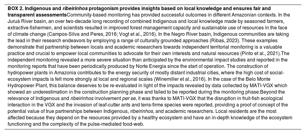
| BOX 2. Indigenous and ribeirinhos protagonism provides insights based on local knowledge and ensures fair and transparent assessmentsCommunity-based monitoring has provided successful outcomes in different Amazonian contexts. In the Juruá River basin, an over two-decade long recording of combined Indigenous and local knowledge made by seasoned farmers, extractive-fishermen, and scientists resulted in improved forest management capacity and sustainable use of resources in the face of climate change (Campos-Silva and Peres, 2016; Vogt et al., 2016). In the Negro River basin, Indigenous communities are taking the lead in their research endeavors by employing a range of culturally grounded approaches (Ribas, 2023). These examples demonstrate that partnership between locals and academic researchers towards independent territorial monitoring is a valuable practice and crucial to empower local communities to advocate for their own interests and natural resources (Pinto et al., 2021).The independent monitoring revealed a more severe situation than anticipated by the environmental impact studies and reported in the monitoring reports that have been periodically produced by Norte Energia since the start of operation. The construction of hydropower plants in Amazonia contributes to the energy security of mostly distant industrial cities, where the high cost of social-ecosystem impacts is felt more strongly at local and regional scales (Winemiller et al., 2016). In the case of the Belo Monte Hydropower Plant, this balance deserves to be re-evaluated in light of the impacts revealed by data collected by MATI-VGX which showed an underestimation in the construction planning phase and failed to be reported during the monitoring phase.Beyond the relevance of Indigenous and ribeirinhos involvement per se, it was thanks to MATI-VGX that the disruption in fruit-fish ecological interaction in the VGX and the invasion of leaf-cutter ants and terra-firme species were reported, providing a proof of concept of the potential value of true partnerships between Indigenous, ribeirinhos, and academic researchers. Local residents are the most affected because they depend on the resources provided by a healthy ecosystem and have an in-depth knowledge of the ecosystem functioning and the complexity of the pulse-mediated food-web. |
Norte Energia Inc. regulates the flow of water into VGX, determining the fate of the seasonally flooded ecosystems and of indigenous and ribeirinhos food security and livelihood. The currently applied water discharge regimes are extremely low and distinct from the natural flood cycles. The ongoing processes of depletion of seasonally flooded ecosystems will likely result in irreversible socio-environmental harm. Vegetation mortality may be worsened by the interplay between the extreme drought events trend as a consequence of global warming (https://www.ipcc.ch/report/ar6/syr/) and local impact caused by the Belo Monte Hydropower Plant. The impact on seasonally floodable environments and species' life cycles has far-reaching consequences for the Indigenous and ribeirinhos communities, jeopardizing their sociocultural way of life and access to essential resources for rituals and traditional fisheries. Conservation efforts and research conducted independently and involving local communities are essential to better understand and address the long-term consequences of these structural shifts.
The most effective mitigation measure for the impacts reported here would be to return the VGX hydrological conditions as close as possible to the natural flood pulse. Access to water is a basic right and should not be sold as a commodity in Amazonia or anywhere. Efficiently restoring natural hydrological patterns and mitigating factors contributing to reduced water flow is crucial for preserving the ecological integrity and biodiversity of these unique Amazonian forests and the ecosystem services they provide.
We thank Conselho Nacional de Desenvolvimento Científico e Tecnológico (INCT-Peixes); Fundação Ford; Fundo CASA; Fundação Amazônia de Amparo à Estudos e Pesquisas do Estado do Pará (FAPESPA - Iniciativa Amazônia +10); Fundação de Amparo à Pesquisa do Estado do Amazonas (FAPEAM - Iniciativa Amazônia +10 and CLAMBIO consortium/BiodivERsA 2019-2020 COFUND Call); Fundação de Amparo à Pesquisa do Estado de São Paulo (FAPESP grant 2022/10323-0 - Iniciativa Amazônia +10); Academy of Finland (CLAMBIO consortium/BiodivERsA 2019-2020 COFUND Call, #344733); German Federal Ministry of Education and Research (CLAMBIO consortium/BiodivERsA 2019-2020 COFUND Call. BMBF #16LC2025A), Project PELD-MAUA 441811/2020-5 (CNPq) and 01.02.016301.02630/2022-76 (FAPEAM) and Instituto Socioambiental for financial support. Permits were obtained from FUNAI and ICMBio. We also thank AYMIX - Associação Yudja Mïratu da Volta Grande do Xingu, the inhabitants of Volta Grande do Xingu and Espelho region for comprehensive support and dialogues and Kelvin Uchoa Carvalho for designing Fig. 1.
The following are Supplementary data to this article:

